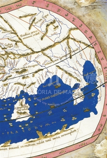
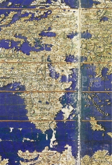
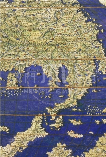
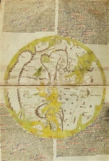
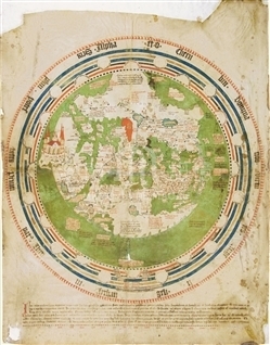
This is a sumptuous humanistic codex of remarkable value from the points of view of iconography, decoration and script. It was a manuscript of exquisite taste and fabrication, a witness to technical and scientific knowledge as well as an instrument for practical use. It was made around the year 1470 by the Hungarian Cardinal János Vitéz (1408-1471), as shown in the coat of arms on f. 1r. F. 1r-v contains the dedicatory epistle to Pope Paul II from the German cartographer and printer Nicolaus Germanus, who had undertaken an update of the cartography in Ptolemy's work. It follows the Geographia in the latin version of Iacopo d'Angelo da Scarperia (ca.1360-ca.1410), which had been completed around the year 1409. The cartographic apparatus in the recensio of Nicolaus Germanus (ff. 74v-132v) comprises a planisphere (ff. 74v-75r); 13 maps dedicated to Europe; four maps of Africa and twelve of Asia, including the eleventh relative to the Far East, i.e. 'Indiam extra Gangem fluvium' (India beyond the Ganges River) and the 'Sina regio' (China region).
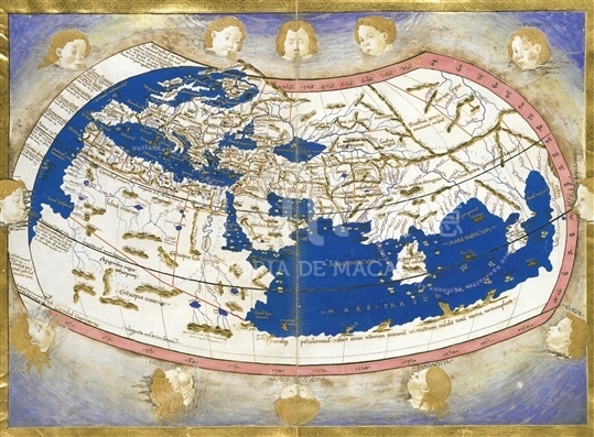
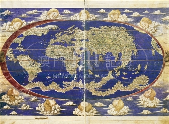
Of particular interest is an elliptical planisphere added around the year 1530 on two sheets which had been left blank (ff. 73v-74r), whose dimensions, excluding the non-cartographical elements (putto's heads symbolizing the winds, etc.), are mm 337 (polar axis)x550 (equatorial axis). This planisphere includes elements of Ptolemaic derivation, such as the excessive latitudinal extension in the representation of the Mediterranean Sea, but also medieval knowledge, indirectly derived, as regards the Far East and China, Marco Polo's reports, for example the excessive distance between 'Cinpagu' (Japan) and the Asian coast, or the Chinese place-names. (Cataio, Mangi, Zaiton and Cuizanfu ). On the other hand, the representation of Northern Europe, of the African coast, the island of Madagascar, and the Antarctic lands. In general, however, the Planisphere had not reflected the new geographical knowledge of Asia gained in the Portuguese explorations and subsequent maritime trade in the early decades of the sixteenth century. In fact, the maps lack precise information about the Moluccas, the Philippines and the Chinese coast where there were the Portuguese bases. Even though Sinarum situs had reported Macao and the Lingding Islands, the both islands remained unrecognizable.
Brief summaries preceded each map, with notes on the each regions and a list of cities. Finally there is a list of lands and regions, following the order of the maps, with the numerical values of cartographic coordinates.
Reference:
[1]. ALMAGIÀ, R. (1944). Planisferi arte nautiche e affini dal secolo XIV al XVII esistenti nella Biblioteca Vaticana. In Monumenta cartographica Vaticana (vol.1, pp.58-59, nr. 19, tav. XXX). Città del Vaticano.
[2]. Biblioteca Apostólica Vaticana. (2006). La 'Geographia' de Ptolomeo (Urb. lat. 274). In Codices e Vaticanis selecti. Series maior, 48; Colección Scriptorium, 21. Madrid - Città del Vaticano.
[3]. DUVAL-ARNOULD, L.; MARCOTTE, D.; HERNANDO, A. (2008). Commento: Ptolemæus Latinus. Codex Urbinas Lat. 274 conservado en la Biblioteca Apostólica Vaticana. French translation by I. RUIZ ALBI. In Colección Scriptorium, 21. Madrid - Città del Vaticano.
Anotações: 選自斯卡爾佩里亞拉丁文版托勒密《地理學》
Informações relevantes
Data de atualização: 2020/09/08




Comentários
Comentários (0 participação(ões), 0 comentário(s)): agradecemos que partilhasse os seus materiais e histórias (dentro de 150 palavras).