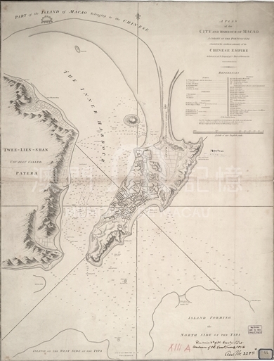
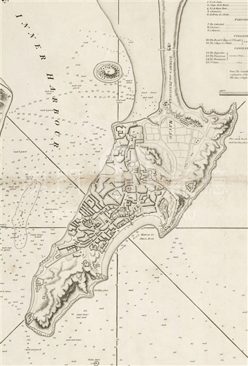
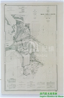
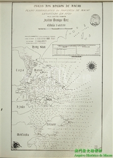
This map is included in a book “An Authentic Account of and Embassy from the King of Great Britain to the Emperor of China” by Staunton, deputy ambassador of Ma Cartney Mission to China. This book is an important historical material to study histories in middle Qing Dynasty, for it showed in a westerner’s eye the prosperity of that time. The cartographer, Benjamin Baker, who then was the principal engraver in British Ordnance Survey, was famous for his skills in mapping of great precision and accuracy and in charge of the work of platemaking of maps on a scale of 'one inch to one mile.' In fact this map is made on a scale of 1:32600, with Greenwich meridian as the beginning of longitude. The location of Macau is marked as east longitude 113°35′00″, north latitude 22°12′44″one the basis of the Great Landing Place, which is identical to the modern mapping results. The accuracy is rather impressive. The whole map is a bird’s view high in the sky, depicting a vivid image of Macau Peninsula, surrounding hills, coasts, intertidal zones and rivers. The depths of watercourses around are densely marked. The southeast outline of Macau Peninsula is nearly the same with Macao Road and Dr. Loughridge Road. The northeastern part resembles today’s Morais Road and Fishermen Street, from which historical changes can be identified as a result of a scheme “Filling the sea, building the city” implemented by Peninsula administration. On the map streets inside the city are marked but not given names. Symbols of digits stand for critical spots like fortress, churches and yards, colleges, abbeys, and etc. Their names are given by lists according to a form frequently employed in modern maps on top right of the map. It should be noticed that what is marked as No.37, the British Bank, should be the former site of Macau Branch of East India Company, which shipped large sums of opium to China at the end of 18th century and contributed to Macau’s old flourishing days as a stronghold of smuggling drugs.
This is a copy of “G7823.M2 1796 .B3 TIL” preserved in the Library of Congress, U.S.A.
Reference:
[1]. Seymour, W. A., & Andrews, J. H. (1980). A History of the Ordnance Survey (pp 69-70, 101, 105). Folkestone, Kent, England: Dawson.
[2]. Beinecke Library, Yale University. (2014). A plan of the city and harbour of Macao, a colony of the Portuguese situated at the southern extremity of the Chinese Empire. Retrieved 2014-9-26, from http://brbl-dl-dev.library.yale.edu/vufind/Record/2016895
[3]. Batten, K., & Bennett, F. (2014). 57 Benjamin Baker 1791. Retrieved 2014-9-26, from http://www.printed-maps-of-devon.eu/057t. php#fn001f
Informações relevantes
Data de atualização: 2020/09/09




Comentários
Comentários (0 participação(ões), 0 comentário(s)): agradecemos que partilhasse os seus materiais e histórias (dentro de 150 palavras).