Diego Ribero was a Portuguese (Lusitanian) at Seville in the service of King Carlos I of Spain. For many years he was recognized as one of the most expert cosmographers of his time. He was closely associated with all of the noted explorers who gathered about the Spanish court. He was a personal friend of the Pilot Major, Sebastian Cabot, was the royal cosmographer under King Ferdinand for Columbus; and made the maps that Magellan carried with him on his famous voyage across the Pacific. Ultimately Ribero succeeded Sebastian Cabot as Pilot Major.
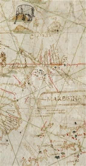
This planisphere, entitled at the upper and lower edges, 'Carta Universal en que Se contiene todo lo que del mundo se ha descubierto fasta agora hizola Diego Ribero cosmographo de Su magestad Año de 1529 en Sevilla. La qual se devide en dos partes conforme ala capitulacion que Hizieron los catholicos Reyes de españa y el Rey don Juan de Portugual en Tordessilas año de 1494', is one of the most famous cartographic achievements of the Age of Discovery, considered by many scholars the finest cartographic production of its age. It actually includes all the known world, at the time, including a small strip with 'Mare Sinarum' repeated twice at its two opposite ends. The planisphere is delineated in the style of nautical charts. The two flags of Spain and Portugal represented in the Southeast corner of the map and on the coast of China indicate the location of the Line of Demarcation. The route taken by the famous Magellan expedition in 1519-20 is marked on Ribero's map by drawings of his first two ships, the Victoria and the Trinidad. The planisphere shows an increasingly accurate presentation of Southeast Asia, particularly the Moluccas, which is notable. It is also the first European cartographic representation to show Canton ('cantam' marked in red on the map), its environs and the Pescadores Islands. The drawing of the East Asian Coast north of the Tropic of Cancer is interrupted. There is no trace of Japan. Regarding Java there is only its Northern coast. Some sections of the Indochina Coast is also missing. Among the descriptives on the map are 'China', 'cantam', 'Mare Sinarum', and 'provincia de maluche'. It is worth to notice there is a place named 'matan' to the southeast of 'cantam' on the bank of the Pearl River Estuary.
Reference:
[1]. ALMAGIÀ, R. (1944). Planisferi, carte nautiche e affini dal secolo XIV al XVII esistenti nella Biblioteca Apostolica Vaticana. In Monumenta cartographica Vaticana (vol.1, pp.50-52). Città del Vaticano.
[2]. SIEBOLD, J. (2015). Cartographic Images. Retrieved from http://cartographic-images.net
[3]. DAVIES, S. (2003). The Navigational Iconography of Diogo Ribeiro's 1529 Vatican Planisphere. Imago mundi: the Journal of the International Society for the History of Cartography, 55, pp. 103-112 passim, fig.1-3, tav.12.
[4]. Milano, E. (2002). I Mappamondi di Gerolamo Verrazzano e Diego Ribeiro. In Alla scoperta del mondo: l'arte della cartografia da Tolomeo a Mercatore [catalogo di mostra, Modena, Biblioteca Estense Universitaria, 10 gennaio-30 aprile 2002], pp. 149-154.
Informações relevantes
Data de atualização: 2020/09/08




Comentários
Comentários (0 participação(ões), 0 comentário(s)): agradecemos que partilhasse os seus materiais e histórias (dentro de 150 palavras).