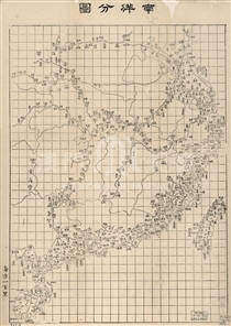
Samuel Wells Williams was a 19th century American Protestant missionary, diplomat and scholar, who worked in China for over 40 years from the beginning of 1833 and participated in a number of major affairs in the early history of Sino-US relations. In 1848, Williams published the book Chinese Empire (The Middle Kingdom) known as “Encyclopedia of Chinese Empire”, to which was attached a map of China drawn by him. When Chinese Empire was republished in 1883, Williams painted a more accurate map of China (the title is The Chinese Empire) as the appended map. The map described now was engraved on plate by J. M. Atwood and published in New York in 1853. As the European and American countries conducted long-term surveying and mapping in China after the Opium War, the shape of the Chinese coastline on this map is very accurate, pretty close to the modern map. Macao was depicted on the estuary of the Pearl River; meanwhile, six illustrated maps was attached in the lower left, upper left, lower right, including two of 'City of Canton & Adjacent Islands', 'Harbor & Island of Amoy', ' Passage up to Shanghai', 'Passage up to Ningpo', 'River Min to Fuhchau Fu'. 'City of Canton & Adjacent Islands' depicts the neighboring region of Macau and islands, including Green I. (Qingzhou), Barrier (Border Gate), Macao, Typa, Apomee I. (Coloane), and from the east of Macau to Guangzhou estuary was marked as 'Macao Roads.' In particular, the position of Diaoyu Islands was clearly manifested near Taiwan Island (i.e. the “taiyusu” island on the map, in the southwest of which lies Huapingshan Island).
This copy is a single map from the Harvard Map Collection (G7810 1853 .W5).
Reference:
[1]. Williams, S. W. (1848). The Middle Kingdom. New York & London : Wiley & Putnam.
[2]. 孔陳焱. (2010). 衛三畏與美國漢學研究. 上海:上海辭書出版社.
Informações relevantes
Data de atualização: 2020/09/09


Comentários
Comentários (0 participação(ões), 0 comentário(s)): agradecemos que partilhasse os seus materiais e histórias (dentro de 150 palavras).