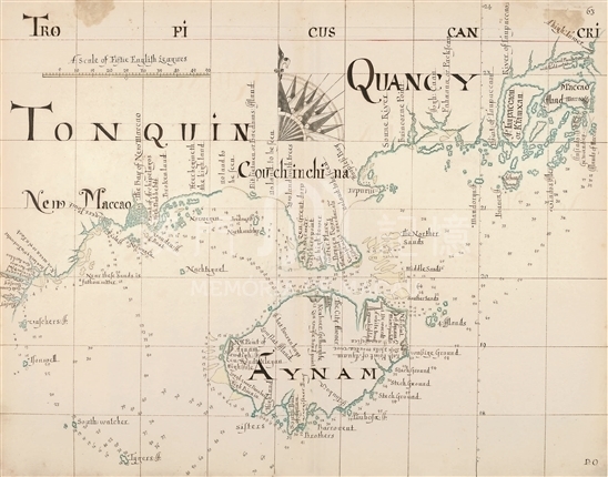
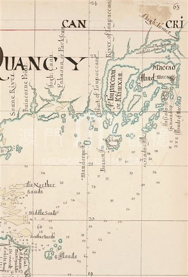
As a part of A description of the sea coasts ... in the East Indies, this atlas was named after the notorious pirate Captain Bartholomew Sharp’s sailing experience and mapping, so also known as “Buccaneer atlas”. William Hacke, the mapmaker of the atlas was a professional hand-drawn cartographer in London. It was believed that Hack followed Captain Sharp in his sailing. The atlas contains 94 maps, covering the voyage to India, East Africa, East Asia's coastline; this map is the 63rd one. Mercator projection was employed so the latitude and longitude lines intersect to form right angles. The water depth of the surrounding coastline, distance, anchorage and other useful data were recorded for the help of nautical activities and piracy. The map depicts southern coastal areas from Macau (then Maccao) in the east to Tokyo Bay (TONQUIN now northern Gulf ), and Hainan Island (then AYNAM) and the Leizhou Peninsula is located in the center of the map. Its coastline became more accurate, but the position names was mistaken, For example, Leizhou Peninsula and its east should be Guangdong Province, but was marked as Guangxi (QUANCY) instead. A large island in the northeast corner of the map was marked as Maccao and Island Maccao, which should actually be the Xiangshan and Macau; while on the right side to the south of the island and several small islands was written as Island of Maccao; which reflects the mapmaker was confused about the geography location of Macau. Interestingly, in the westernmost above the Gulf of Tonkin, “New Maccao” was marked with a conspicuous font. It's worthy of further study that two places both named after macao departed in the east and the west.
This map is copied from the United States Library of Congress Map Division collection 'A description of the sea coasts ... in the East Indies' (G2201.P5 H3 1690).
Reference:
[1]. Ringrose, B., Howse, D., Thrower, N. J. W., Cimolina, T. A., & Quinn, D. B. (1992). A buccaneer's atlas: Basil Ringrose's South Sea waggoner. Berkeley: University of California Press.
[2]. Library of Congress. (2014). A description of the sea coasts ... in the East Indies. 2014-9-30 Retrieved from http://lccn.loc. gov/2002626774
Informações relevantes
Data de atualização: 2020/09/09


Comentários
Comentários (0 participação(ões), 0 comentário(s)): agradecemos que partilhasse os seus materiais e histórias (dentro de 150 palavras).