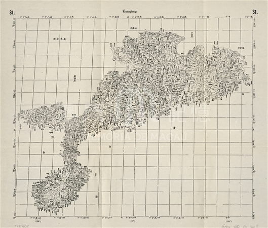
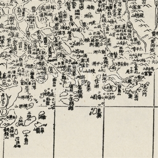
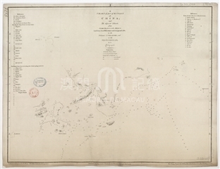
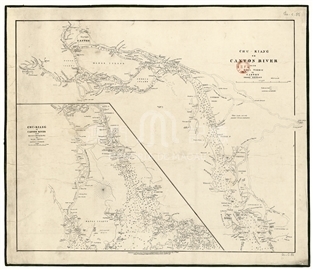
As one of the “Kangxi Imperial Atlas of China”, this map was drawn with vertical and horizontal lines showing clear latitude and longitude. Macau was marked at latitude 22°15′, longitude 3° 18' (to pass through Beijing's zero longitude meridian, with the equivalent of longitude 113° 8′ in the Greenwich Meridian), which was pretty close to the actual latitude as 22° 11′, longitude 113° 32'. This detail showed that “Kangxi Imperial Atlas of China” was made by the method of mapping, so the content was precise with the actual data. On the northern part of Istmo Ferreira do Amaral marked ' 澳門,' namely the Border Gate today. On the south of Macau Peninsula, another small circle on the right marked ' 濠鏡澳,' referring to Macau City. To the left of the sea, a small circle marked ' 清州,' referring to Qingzhou island to the west of Macau (now connected to Macao Pennisula by the land reclamation from the sea). There are three unmarked islands to the south of the mark of ' 濠鏡澳,' one of which should be Taipa and another Coloane, and the third was from nowhere. Two larger islands was marked on the west of those islands, but without name; ' 十字門洲' was marked on the waterway of Taipa and Coloane. The two islands are actually Hengqin islands. Serveral mistakes can be seen as the West River estuary (now Zhuhai Modaomen) was labeled as Jiangmen Sea, stretching outer was marked with large Hengqin Hill, small Hengqin Hill. To the Further south were other islands, like the Sanzao Mountain and Gaolan Mountain. Stretching from Macao to the East China Sea was dotted with many small islands, Jiuxing Ocean, and Ling Ding Island. The north of Macao as marked with Qianshan Zhai, with its west side as a waterway across the land. ' 香爐山' was marked in its north and ' 香山縣' to its north. Those details of and around Macau, including those names of places, islands and smaller islands, are boast of its preciseness. Despite some mistakes, those document provide an important basis to Macao historical geography research.
This map is copied from “Der Jesuiten-Atlas Der Kangshi-Zeit”, from the Map Department of Library of Congress in the United States. Later in 1943, Walter Fuchs (1902-1979) reprinted and published the atlas in Beijing Furen University, covering 32 woodcut edition of “The Kangxi imperial atlas of China” in 1721, coupled added with four “He Yuan Tu” (Map of the Yellow River Source) in the 1717edition. So this is the 31st one out of the total thirty-six maps (G7820 s000 .R4).
Reference:
[1]. 林天人編撰; 張敏英文編譯. (2013). 皇輿搜覽 : 美國國會圖書館所藏明清輿圖 ( pp67-74.). 臺北 : 中央研究院數位文化中心; Washington D.C. : 美國國會圖書館.
[2]. 馮寶琳. (1985). 康熙《皇輿全覽圖》的測繪考略. 故宮博物院院刊, 第一輯.
[3]. 李孝聰. (2012). 記康熙《皇輿全覽圖》的測繪及其版本. 故宮學術季刊, 30卷第1期( 秋季號).
Informações relevantes
Data de atualização: 2020/09/09





Comentários
Comentários (0 participação(ões), 0 comentário(s)): agradecemos que partilhasse os seus materiais e histórias (dentro de 150 palavras).