

")


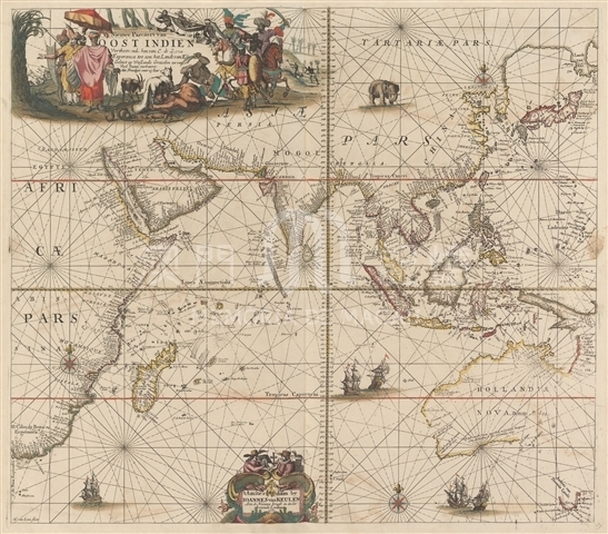
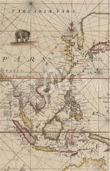
Johannes van Keulen was a famous cartographer in the Netherlands in 17th century and he was also an important map publisher. The map publishing company founded by him was still renowned until the 19th century under the careful management of their descendants. Maps by Keulen reflect the expansion process of the Dutch in the Asia-Pacific region. On this map, the current western coast of Australia was clearly drawn and marked as “New Holland” (Hollandia Nova). Chinese coastline is more accurate, which shows not only the protruding Shandong Peninsula but also Bohai Bay. The shape of Taiwan Island and Hainan Island is very close to the actual geography. An island on the Yangtze River estuary was labeled as Ciongming (Chongming). The map mainly depicts the coastal areas of China, paying less attention to Mainland China. The coastal areas form north to south were labeled LEAOTUNG (Liaodong), PECHELI (North Zhili), XANTUNG (Shandong), NANKING (Nanjing), CHEKIANG (Zhejiang), Fokjen (Fujian), QUANTUNG (Guangdong) and other names, while there are no inland provincial names. In addition, the cartographer did not paint China’s river systems; however, the names of such rivers were noted as the coastal areas of Guangdong appears “R. van Canton”, referring to the Pearl River; on its estuary was portrayed a lot of islands. Macao was not marked on the map, but the north shore of Gulf of Tonkin was depicted with a“ New Macao” (Nova Macao), which merits further research.
This map is copied from Le grand nouvel atlas de le mer, ou Monde aquatique (MA 17.82.2) from the Harvard Map Collection, 1682, French edition, with notes in Dutch.
Reference:
[1]. Vries, D., Persson, N., & Vermeulen, T. (2005). The Van Keulen cartography: Amsterdam, 1680-1885. Alphen aan den Rijn: Canaletto/ Repro-Holland.
[2]. Keulen, J., Keulen, G., & Vooght, C. (1716). De nieuwe groote ligtende zee-fakkel. Amsterdam: Joannes van Keulen.
Informações relevantes
Data de atualização: 2020/09/09
Comentários
Comentários (0 participação(ões), 0 comentário(s)): agradecemos que partilhasse os seus materiais e histórias (dentro de 150 palavras).