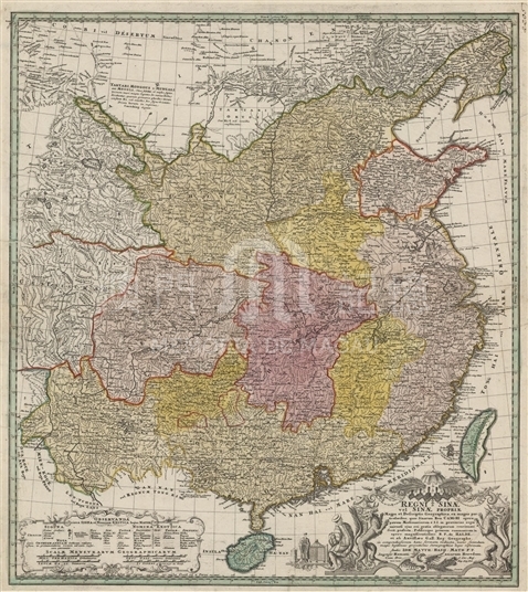
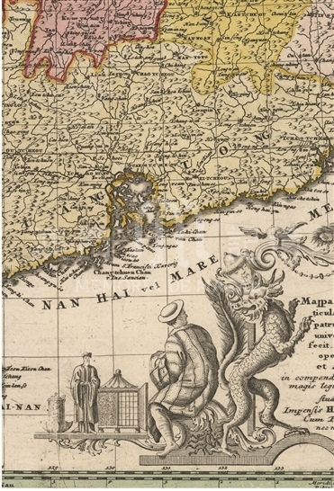
The mapmaker Haas (Johann Matthias Haas, also written as Haase, Hasius, etc.) was a professor of mathematics in Germany, who also drew maps for Homann Erben—the most famous cartography company in Germany at that time. Haas once published an article about cartography and painted many maps, especially the historical maps about ancient empires. In the text description of this map, Haas wrote that the map were drawn according to the map “du Halde and d’Anville” in France which were painted according to the data measured in the Kangxi period. Therefore, this map truly reflects the territory of Qing Dynasty during the reign of Emperor Kangxi. The map was printed with copperplate and painted by hand. There are colored boundary lines between different provinces. The decorative pattern at the lower right corner of the map includes two dragons and a phoenix. The bottom right displays the scale bars and its descriptions. Guangzhou (QUANG TCHEOU) was marked above the Pearl River estuary and Macao (MACAO) was marked below Xiangshan (Hiang chan). Moreover, the map also depicts a number of islands near Macao. On March 2014, German Chancellor Angela Merkel sent this map to Chinese President Xi Jinping at his visit to the European countries.
It is a single map copied from Harvard University Library Map Collection (G7820 1738 .H3).
Reference:
[1]. Bagrow, L. (1966). History of cartography ( pp. 187, 248). Cambridge: Harvard University Press.
[2]. Moreland, C., & Bannister, D. (1983). Antique maps(pp. 86,88,288,312). London & New York: Longman.
[3]. Black, J. (2000). Maps and history: Constructing images of the past (pp. 21-23). New Haven: Yale University Press.
Informações relevantes
Data de atualização: 2020/09/09


Comentários
Comentários (0 participação(ões), 0 comentário(s)): agradecemos que partilhasse os seus materiais e histórias (dentro de 150 palavras).