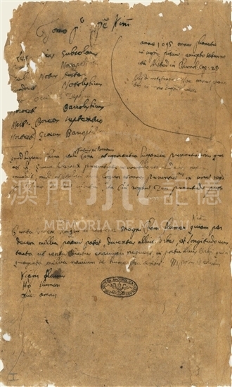
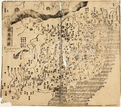
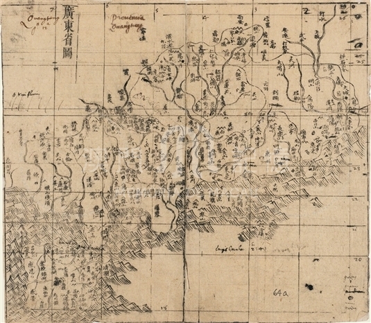
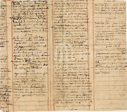
Martino Martini was an Italian Jesuit, who arrived in Macao in 1643, then stayed in China for about eight years. He left China for Rome to appeal to the Curia on the issue of the Chinese Rites controversy. In 1655 Martini's Novus Atlas Sinensis was published by the famous Dutch cartographer Joan Blaeu, and the masterpiece showed the most elaborate scene of Chinese geography to the Europeans of the mid-seventeenth century. Novus Atlas Sinensis was drawed during Martini's voyage and the first period after his arrival of Europe. Vatican Apostolic Library stows the Chinese geographical book Guang Yu Ji which Martini leaned on to draw his maps and write the geographical introductions. Since Martini made a lot of notes directly on this Chinese book in order to assist his work of cartography, this book may be called the 'working edition'. This Guang Yu Ji used by Martini is not the first edition by Lu Ying Yang in 1600, since this edition doesn't involve any map, but is the revision with inserted maps produced in Ningxiang Ge during Wanli Era of Ming Dynasty. The maps are inserted by Yan Zi Yi, which are made by counterdrawing the maps in Luo Hong Xian's Guang Yu Tu made in Jiajing Era of Ming Dynasty. Because of the cursory counterdrawing, the maps themselves has distortions on several parts. On the general map of the 'working edition' of Martini, there is only Latin interpretation of the title. Whereas on the map of Guangdong, there are a lot of notes by Martini on it. The main notes are as follows. 1. Add a 'reference gridding of longitudes and latitudes', in order to gain the degrees of the points from the 'working edition'. 2. Note the known data of longitudes and latitudes of some places. 3. Add some points showing the newly set up counties in late Ming Dynasty, but the position of them is always wrong. 4. Add the sequence number beside the sites of cities, which accords with the sequence of the cities in the table of longitudes and latitudes and the geographical introductions in the Novus Atlas Sinensis. 5. Some detail changes of the coastline, Latin transliteration of some placenames, and some other notes. There are a great deal of geographical introductions in the Novus Atlas Sinensis. They were also written mainly based on the texts of Guang Yu Ji. We can see many texts in Latin by Martini appended on the 'working edition', which should be the draft of the introductions in the Novus Atlas Sinensis. The texts are worth further study.
Reference:
[1]. 林宏. (2016). 衛匡國《中國新圖志》的繪製方法:基於梵蒂岡藏衛匡國批注本《廣輿記》“廣東省圖”的研究. 載於戴龍基&楊迅凌(Eds.), 全球地圖中的澳門, 第二卷 (347-397). 北京:社會科學文獻出版社.
[2]. 張西平, 馬西尼, 斯卡爾德志尼. (2012). 把中國介紹給世界:衛匡國研究. 上海:華東師範大學出版社.
[3]. 海野一隆. (2010). 地図文化史上の広輿図. 東洋文庫論叢, 第73種. 東京:東洋文庫.
Informações relevantes
Data de atualização: 2020/09/08




Comentários
Comentários (0 participação(ões), 0 comentário(s)): agradecemos que partilhasse os seus materiais e histórias (dentro de 150 palavras).