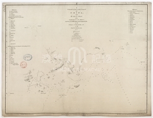
Qianlong Nei Fu Yu Tu (the Complete Map of the Empire of the Qianlong Era) was made in about 1760 of great size, which was divided into 13 rows with the scale of 5° of latitudes in one row, so it is also called Thirteen Rows Qianlong Map. The map was compiled on the basis of Huang Yu Quan Lan Tu (the Complete Map of the Empire of Kangxi Era), and was supplemented with the data gained in the two surveys in Xinjiang and Xizang in 1756 and 1759. Compared with the Kangxi map, the Qianlong map covers a more extensive area, from the Arctic Ocean in the north to India Ocean and South China Sea in the south, and from the Sakhalin Island in the east to the Mediterranean Sea in the west. This map used the same Sanson Projection as the Kangxi map, the meridian through Beijing City is defined as the middle meridian, and the longitudes and latitudes crossed diagonally. The French Jesuit Michel Benoist engraved this map in Beijing. He arrived in Macao in 1744, and moved to Beijing the next year, serving the Qing court for more than 30 years. On the letter of 1773, Michel Benoist mentioned that he had made three plates according as 1 inch, 2 inches and 2.5 inches between the latitude lines. The first two plates are woodcut, and the last one is a copper plate. This map held in Vatican Apostolic Library is a woodcut made around 1760 in 103 sheets, with all place names in Chinese. The maps are bound into a volume, but lacking the 13th row, which includes the Hainan Island. The shape of Pearl River estuary on this map is ultimately the same as that on Kangxi map. The delta of the Pearl River is drawn in detail. But the variance of the alluvial terrain is not exhibited since the counterdraw of the old shape several decades ago. The city of Xiangshan County is noted on a small piece of land at the southwest of the estuary. And there is another lager piece of land on the south, at the south end of which noted “澳門”(Macao) and “濠鏡澳”(Hao Jing Ao). The channel between the above two pieces of land is inaccurate. Furthermore, the position of “大橫琴山”(Da Heng Qin Shan), “小橫琴山”(Xiao Heng Qin Shan ) is marked on the west side of the actual location, and this mistake is also stemmed from the Kangxi map. The position of “清州”(Qing Zhou) on the west of Macao and “十字門洲”(Shi Zi Men Zhou) on the south is accurate.
Reference:
[1]. 李孝聰. (1996). 歐洲收藏部分中文古地圖敘錄. 北京:國際文化出版公司, pp.175-179.
[2]. 汪前進. (2007). 康熙、雍正、乾隆三朝全國總圖的繪製(代序). 載於清廷三大實測全圖集. 北京:外文出版社, pp.1-8.
Anotações: 選自《乾隆內府輿圖》
Informações relevantes
Data de atualização: 2020/09/08





Comentários
Comentários (0 participação(ões), 0 comentário(s)): agradecemos que partilhasse os seus materiais e histórias (dentro de 150 palavras).