

")


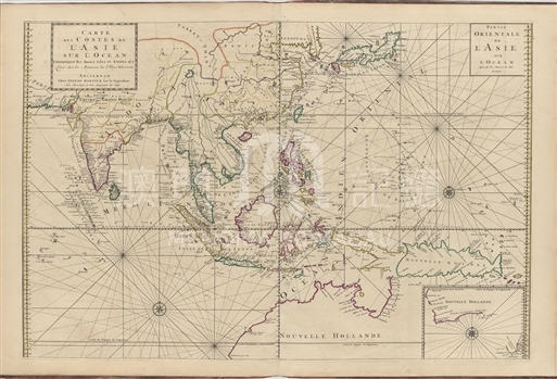
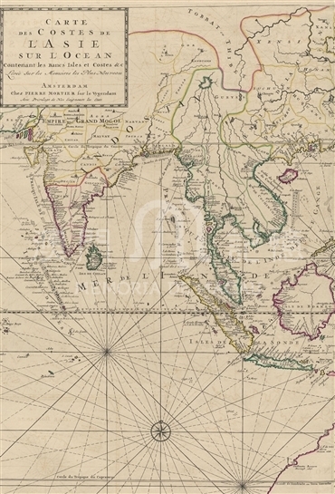
Pieter Mortier was born in Leiden, the Netherlands, and his father was a French political refugee. Mortier had long maintained close contact with French map publishers, and he indicates cartography which highly affected a cartography of Netherlands. At the end of 17th century, French government commissioned a group to map the coast of the European continent. As the outcome of this survey, the altas (Le Neptune François) was engraved and published by French cartography Alexis Hubert Jailot. In 1693, Mortier published a nautical atlas “Le Neptune François” in French in Amsterdam, which was recognized as the most classic and the reliable nautical atlas in his time, and this map is from the atlas. The most significant feature of this map is the detailed depiction of Asian waters, including the Western Pacific and Eastern Indian Ocean. In contrast, Mortier paid less attention to the land areas of Asia and many places were left blank. A lot of place names are marked densely along the coast of East Asia, and islands in the ocean are numerous and accurately painted. In Chinese areas, the portrayal of the southern coastal regions of Yangtze River is relatively close to the actual geographical situation, but there are many errors in the depiction of the northern part. Especially, Shandong Peninsula was severely reduced and the coastline was almost drawn into a straight line, resulting in the severe deformation of Bohai Bay. Next to the black dot in the eastern side of the Pearl River estuary was marked “Quanchue”, referring to the city of Guangzhou. In the Delta of the Pearl River appear three larger islands painted with different colors, among which the green one was labeled as “Macao”, but the red one west of Macau is unknown. Waters south of the Pearl River estuary has many small islands. Notably, a small bay on the west side of the Leizhou Peninsula was marked “Bay of Nova Macao” (original mark: Macoo, which means the bay of new Macau), which deserves further research.
This map is copied from Suite du Neptune François collected in Harvard Map Collection. (MA 17.93.2 pf )
Reference:
[1]. National Library of the Netherlands. Neptune François. 2015-1-15 Retrieved from http://www.kb.nl/en/web-exhibitions/100-highlights-of-the-koninklijke-bibliotheek/from-1-to-100/60-neptune-francois
[2]. Van Egmond, M. (2002). The Secrets of a Long Life: The Dutch Firm of Covens & Mortier (1685-1866) and Their Copper Plates. Imago Mundi, Vol. 54, pp. 67-86.
[3]. Wolter, J. A., Grim, R. E., & Library of Congress. (1997). Images of the world: The atlas through history (pp. 102-103). New York: McGraw-Hill.
Informações relevantes
Data de atualização: 2020/09/09
Comentários
Comentários (0 participação(ões), 0 comentário(s)): agradecemos que partilhasse os seus materiais e histórias (dentro de 150 palavras).