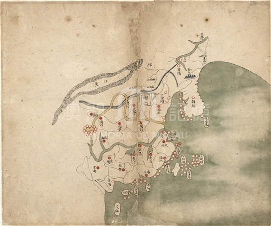
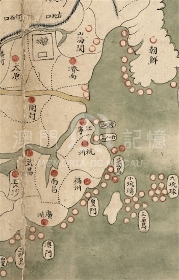
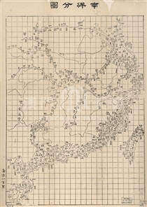
Collected from Provincial atlas of the great Qing Dynasty, this map had no original title, and was named according to its content later, with its cover marked as “Made by Ho Shun Chai.” The Atlas is composed of the general map and other eighteen provincial maps, depicting Qing Dynasty around the 18th century. Without names and the meter boxes, the maps only sketched out by lines the main provinces of Mainland Chinese territory, but do not mark the province names. Solid red circles mark provincial capitals and major cities. The border of Mongolia, Heilongjiang and other places had no outline of territory, with an assumption of the lack of geographical information. Capitals of Korea, Annan and other Chinese vassal state were then marked with a hollow red circle, with the note of their names. The map vividly draw desert, the Great Wall, as well as three major river including the Yangtze River, Yellow River and the Heilongjiang River, and most importantly, the Kaart van Xingxiu Sea, namely the traditional Chinese geographical source of the Yellow River. Without scales, the width of the river was inaccurate. Surprisingly, the map only depicts Changbai Mountain as the only one in the map, with its location in Mukden province. Although the map does not fully depict the Pearl River, it sketches out the Pearl River Delta, with a solid red circle marked as “Guangzhou.” In the southwest sea witness a number of hollow red circles, referring to islands, with a mark of “Macao,” even though without a specific information.
This map is copied from the first one of Provincial atlas of the great Qing Dynasty, from the United States Library of Congress (G2305.D35 1760-1).
Reference:
[1]. 林天人編撰; 張敏英文編譯. (2013). 皇輿搜覽 : 美國國會圖書館所藏明清輿圖 (pp79-82). 臺北 : 中央研究院數位文化中心; Washington D.C. : 美國國會圖書館.
[2]. 朱道清編纂. (1993). 中國水系大辭典. 青島: 青島出版社.
Informações relevantes
Data de atualização: 2020/09/09




Comentários
Comentários (0 participação(ões), 0 comentário(s)): agradecemos que partilhasse os seus materiais e histórias (dentro de 150 palavras).